The data on this website is the property of The City University of New York.
Use of data and information for non-commercial research and teaching is granted with the
understanding of adequate acknowledgment of the research paper.
For commercial use of the data please contact acak@gc.cuny.edu.
A full description of the data and methods is provided in the Supplementary Information available on the Science website.
Delta risk indices and underlying indicator data
| Name | CSV | Excel |
| All Indices |  |
 |
| Anthropogenic Conditioning Index (ACI) indicators | |
|
| Hazardous Event Index (HEI) indicators | |
|
| Investment Deficit Index (IDI) indicators | |
|
| Delta IDs | |
|
Global Delta Maps
Data is in an equirectangular (latitude-longitude) projection using the WGS84 coordinate system.
| Resolution | ASCII | GeoTIFF | Shapefile | |||
| ZIP | TAR.GZ | ZIP | TAR.GZ | ZIP | TAR.GZ | |
| Global - 30 arc-sec |  |
|
 |
|
 |
|
| Global - 2.5 arc-min | |
|
|
|
||
Individual Delta Extent Maps
Data is in an equirectangular (latitude-longitude) projection using the WGS84 coordinate system. Raster formats (ASCII, GeoTiff) are at 250m nominal resolution. Population density in PNG maps is from GRUMPv1 circa 2000.
| Delta | PNG | ASCII | GeoTIFF | Shapefile | |||
| ZIP | TAR.GZ | ZIP | TAR.GZ | ZIP | TAR.GZ | ||
| All | |
|
|
|
|
|
|
| Amazon | 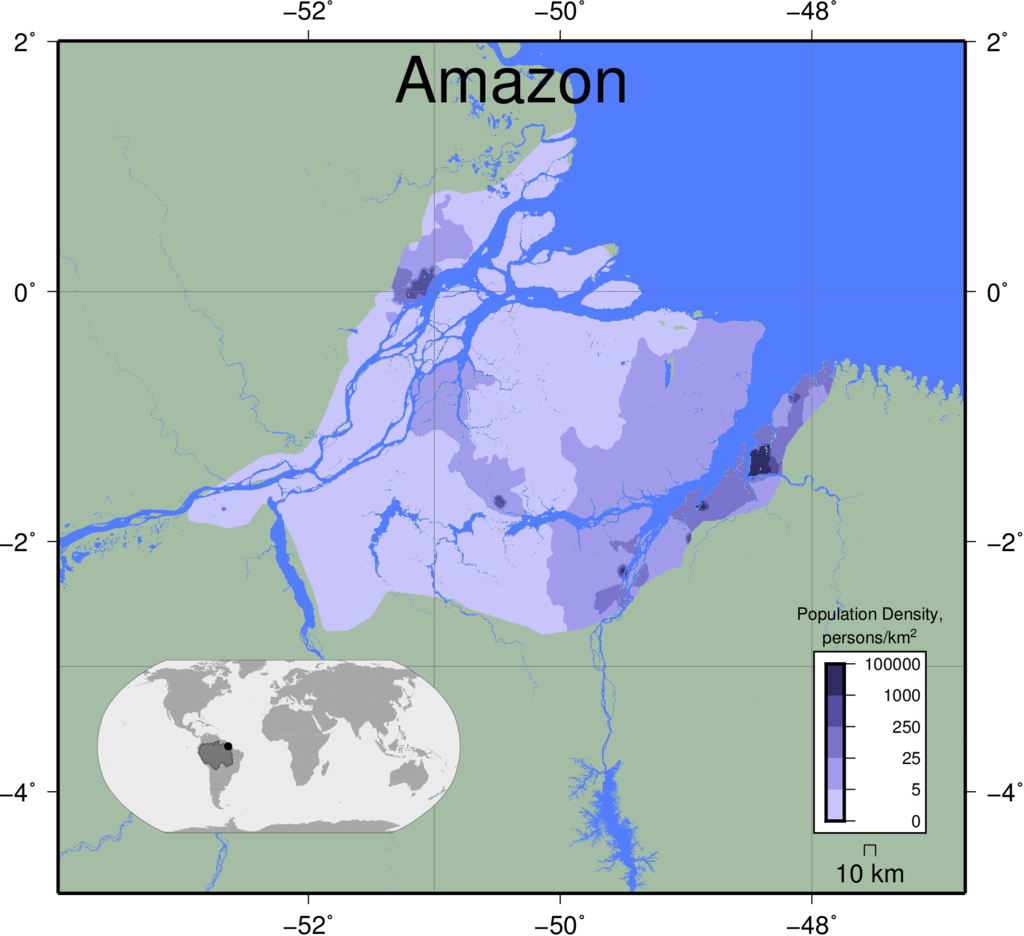 |
|
|
|
|
||
| Amur | 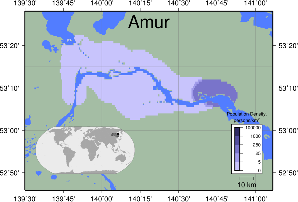 |
|
|
|
|
||
| Brahmani | 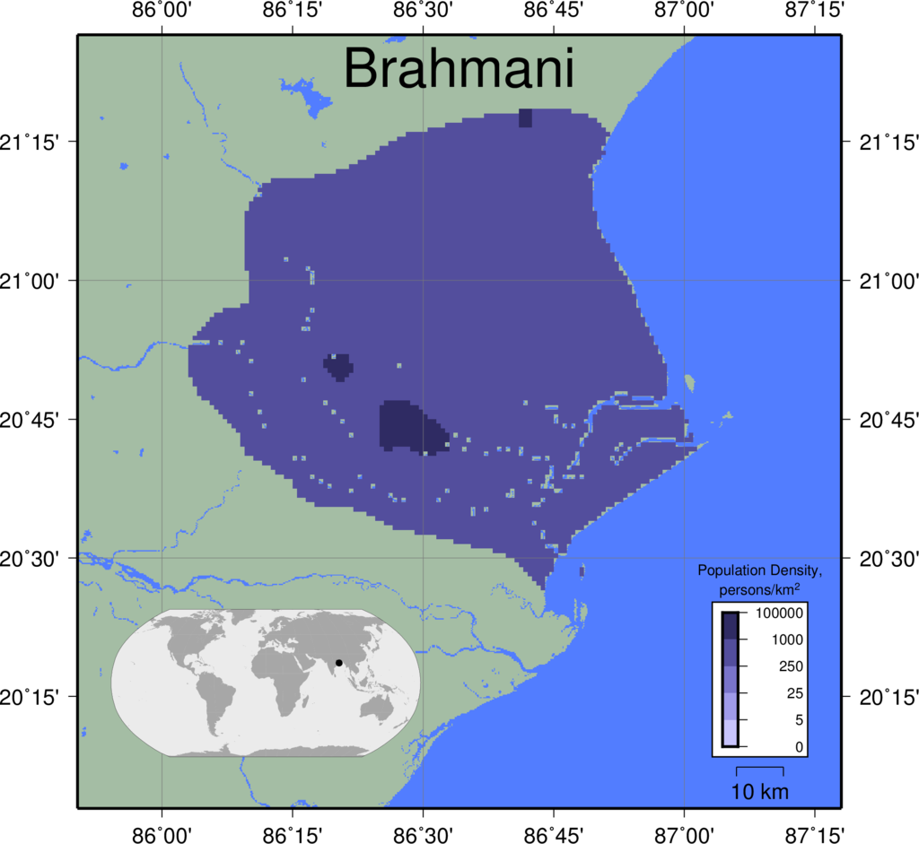 |
|
|
|
|
||
| Burdekin | 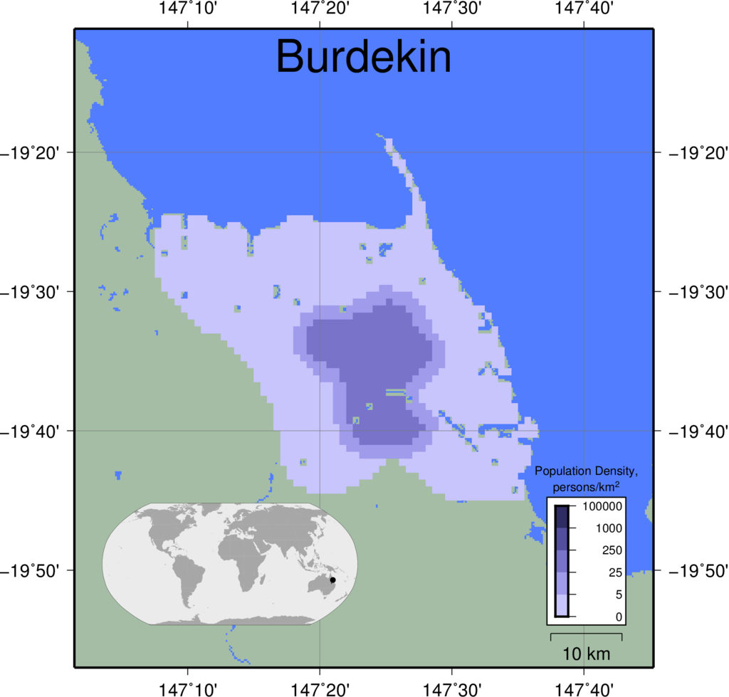 |
|
|
|
|
||
| Chao Phraya | 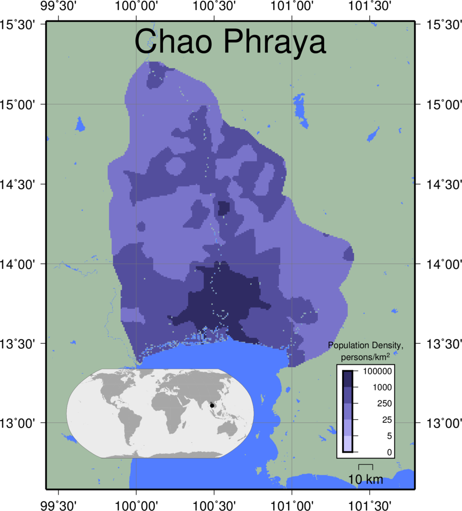 |
|
|
|
|
||
| Colorado | 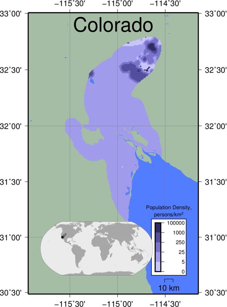 |
|
|
|
|
||
| Congo | 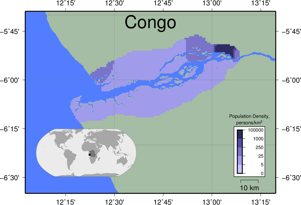 |
|
|
|
|
||
| Danube | 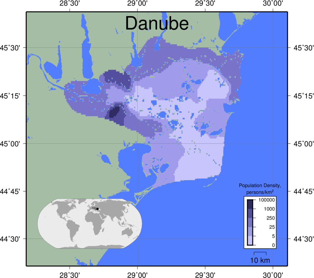 |
|
|
|
|
||
| Dnieper | 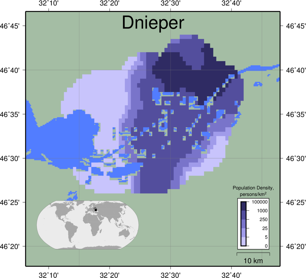 |
|
|
|
|
||
| Ebro | 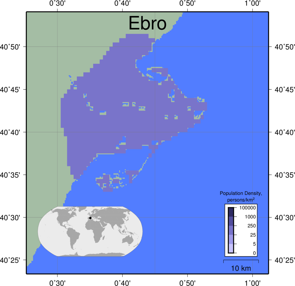 |
|
|
|
|
||
| Fly | 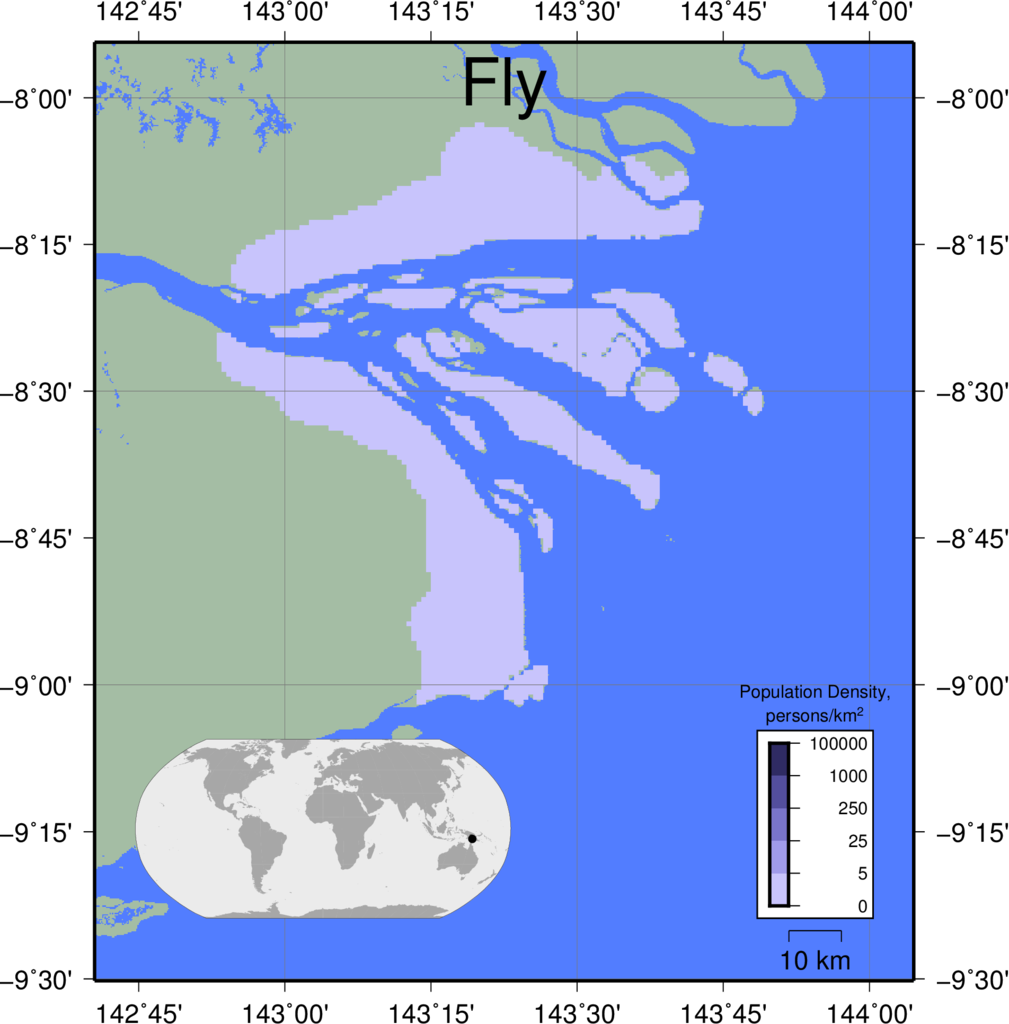 |
|
|
|
|
||
| Ganges | 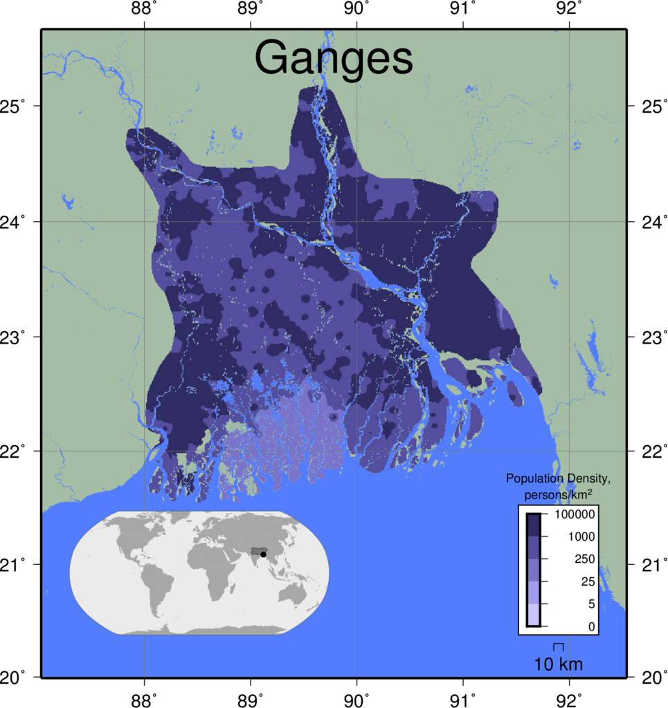 |
|
|
|
|
||
| Godavari | 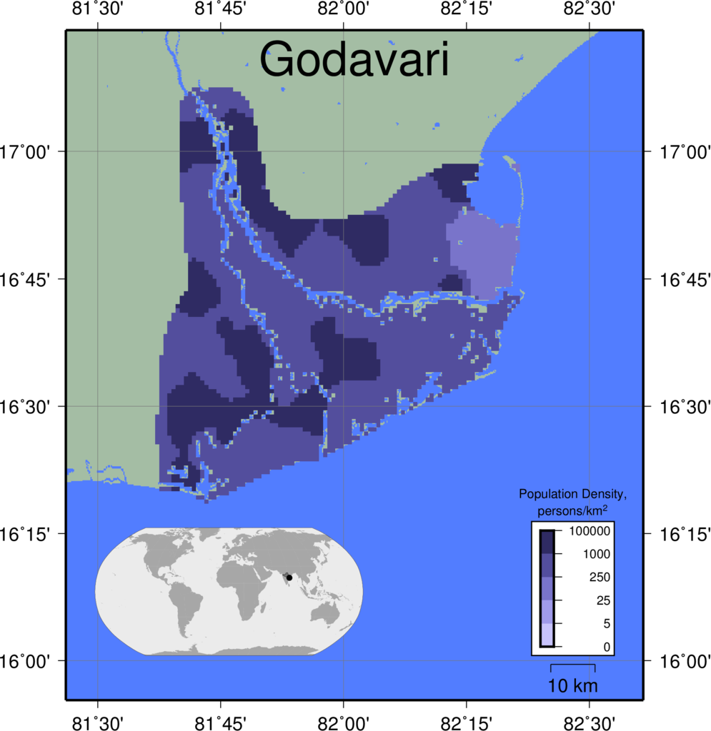 |
|
|
|
|
||
| Grijalva | 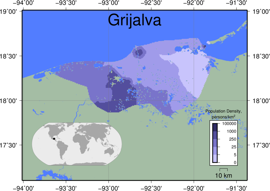 |
|
|
|
|
||
| Han | 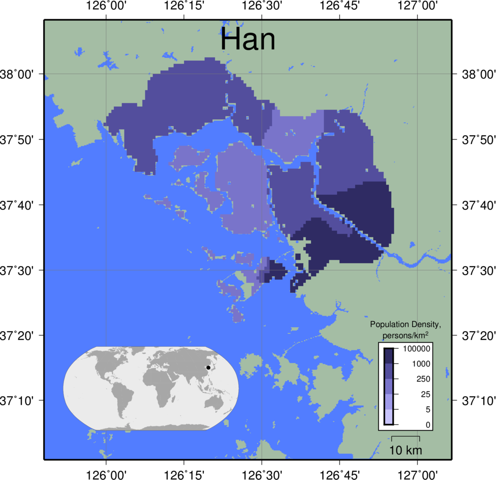 |
|
|
|
|
||
| Hong | 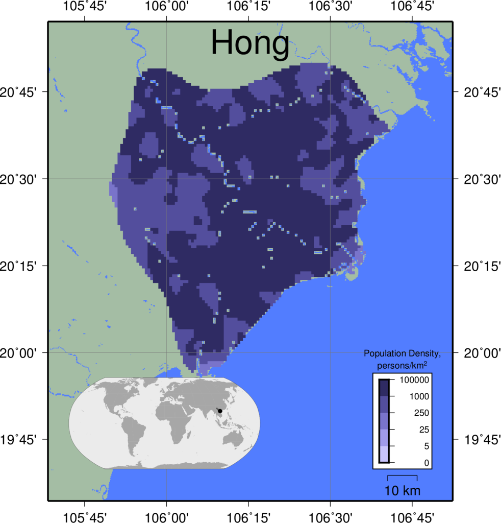 |
|
|
|
|
||
| Indus | 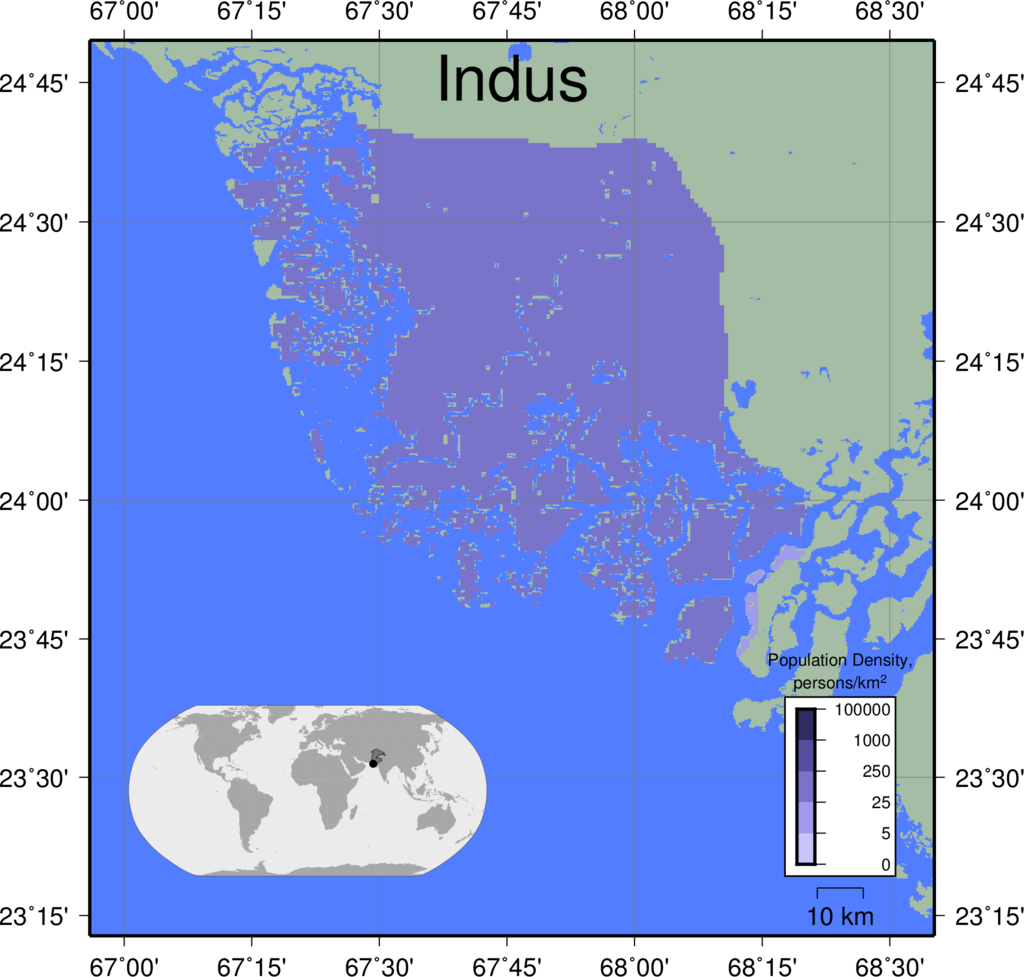 |
|
|
|
|
||
| Irrawaddy | 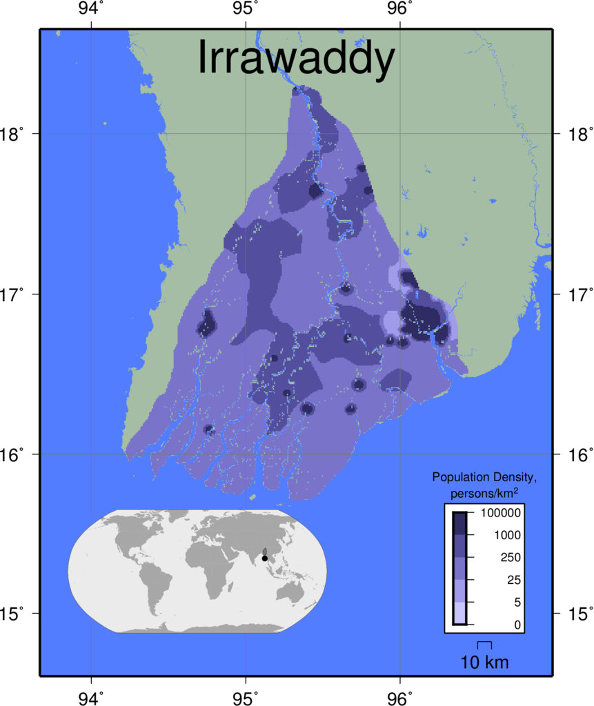 |
|
|
|
|
||
| Krishna | 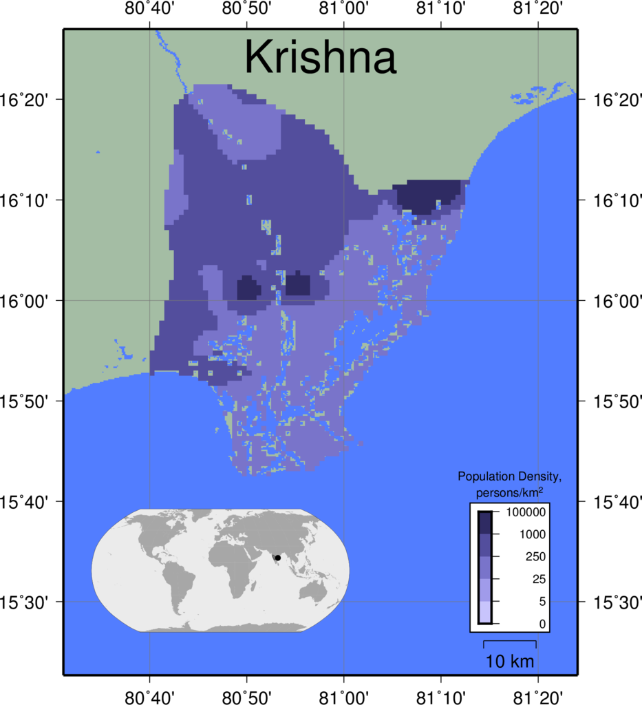 |
|
|
|
|
||
| Lena | 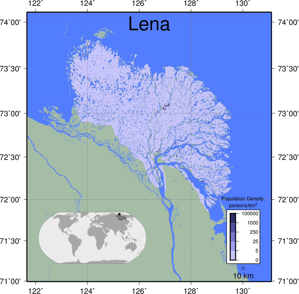 |
|
|
|
|
||
| Limpopo | 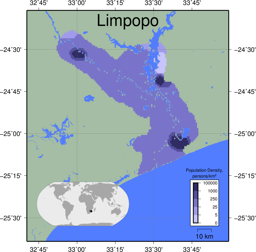 |
|
|
|
|
||
| Mackenzie | 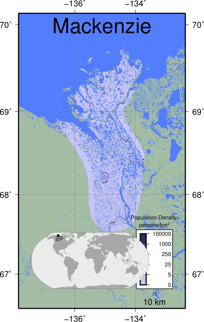 |
|
|
|
|
||
| Magdalena | 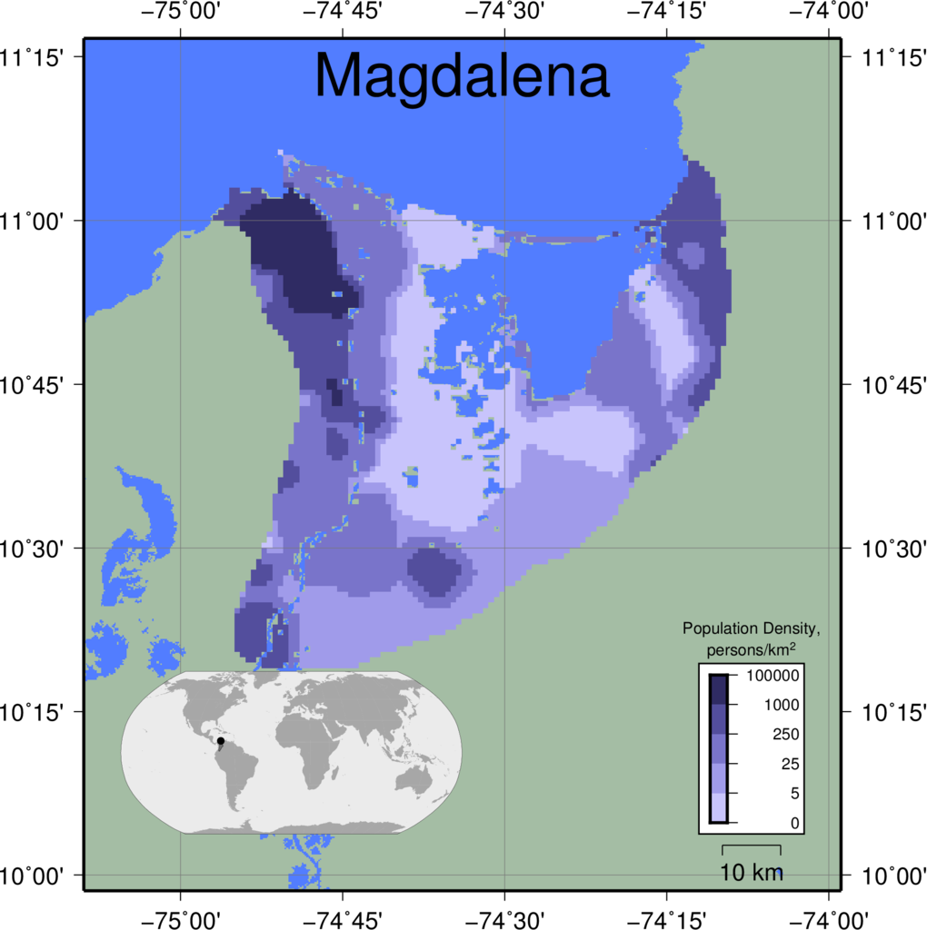 |
|
|
|
|
||
| Mahakam | 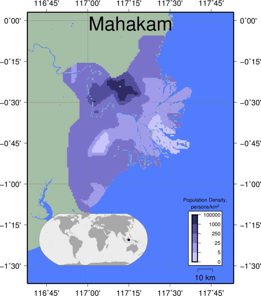 |
|
|
|
|
||
| Mahanadi | 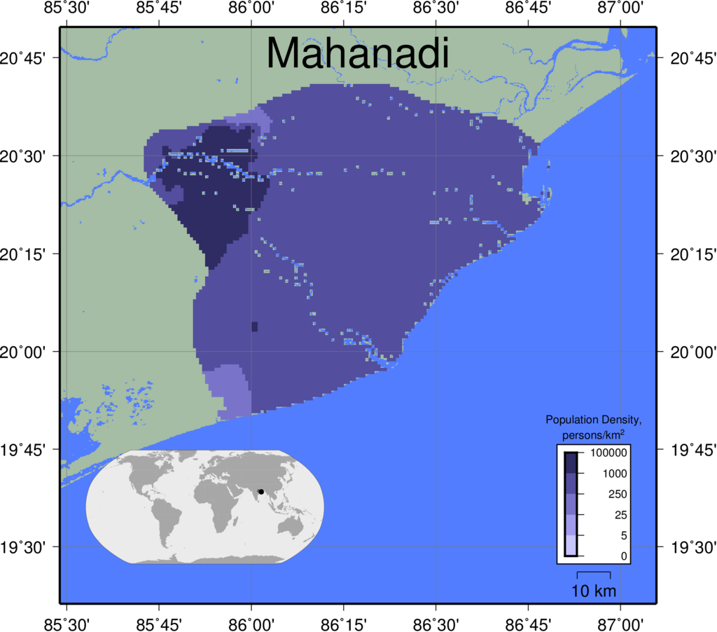 |
|
|
|
|
||
| Mekong | 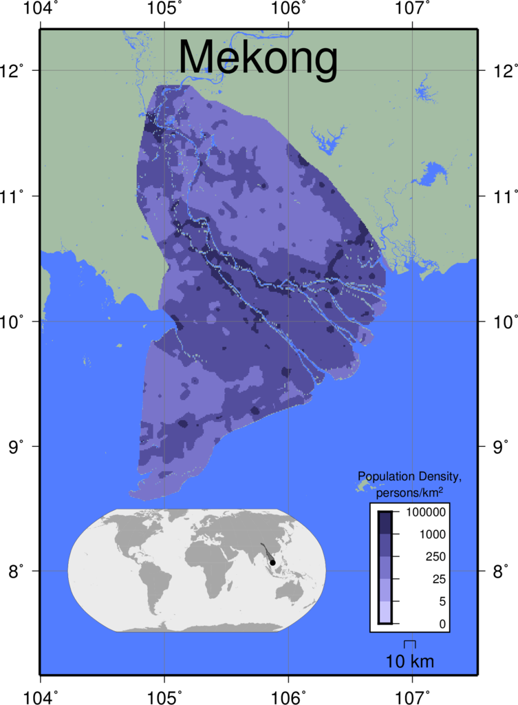 |
|
|
|
|
||
| Mississippi | 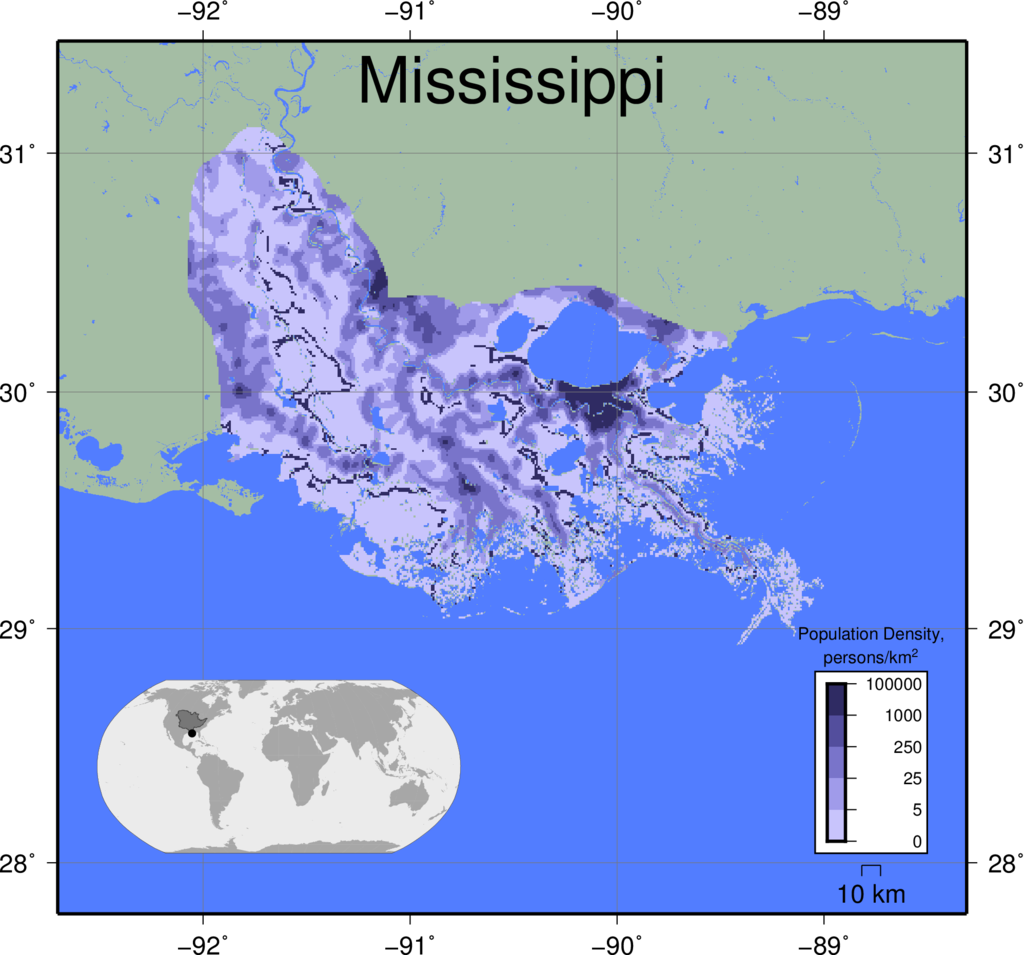 |
|
|
|
|
||
| Moulouya | 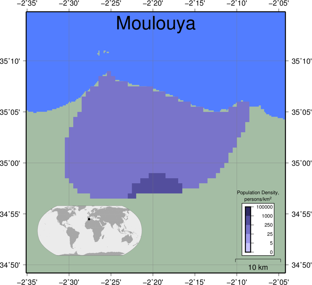 |
|
|
|
|
||
| Niger | 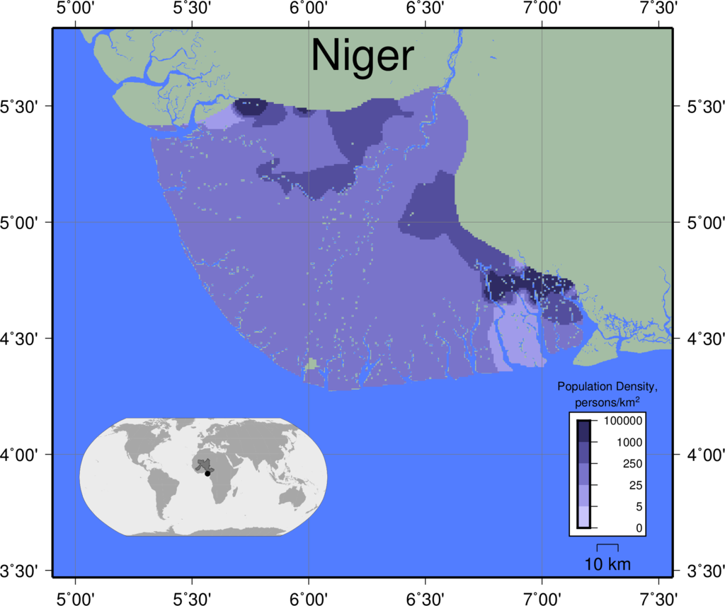 |
|
|
|
|
||
| Nile | 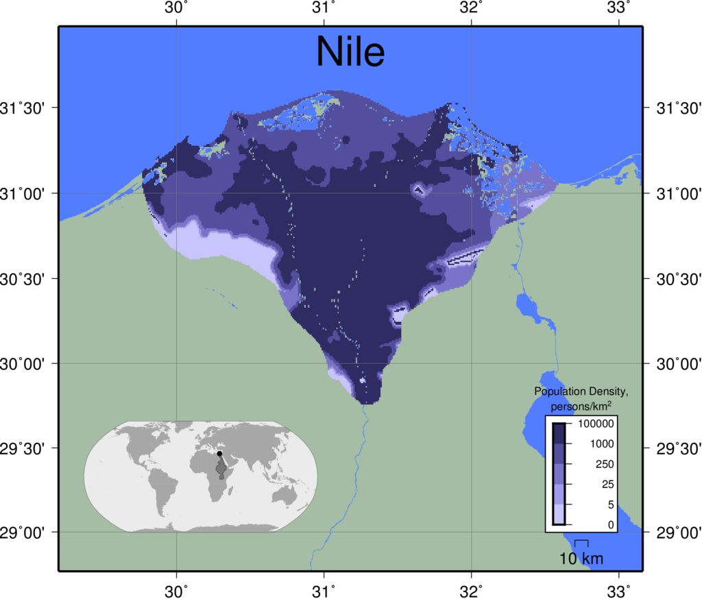 |
|
|
|
|
||
| Orinoco | 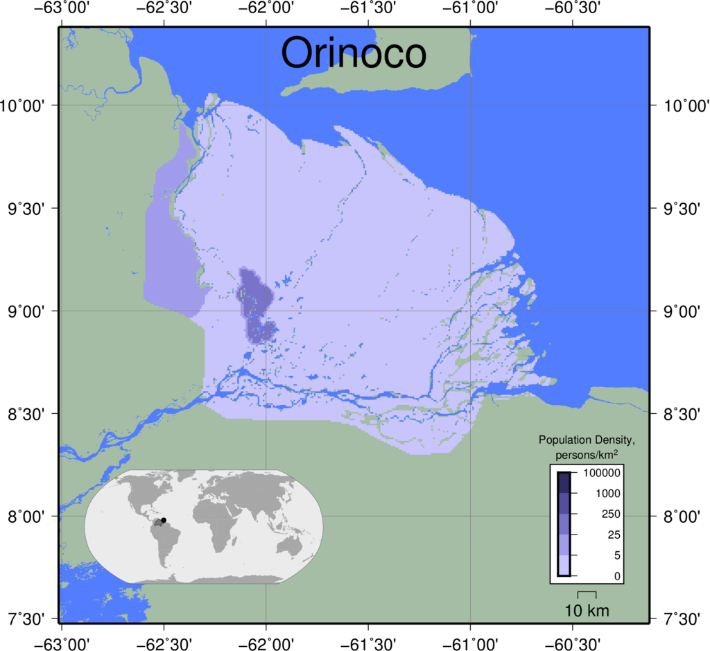 |
|
|
|
|
||
| Parana | 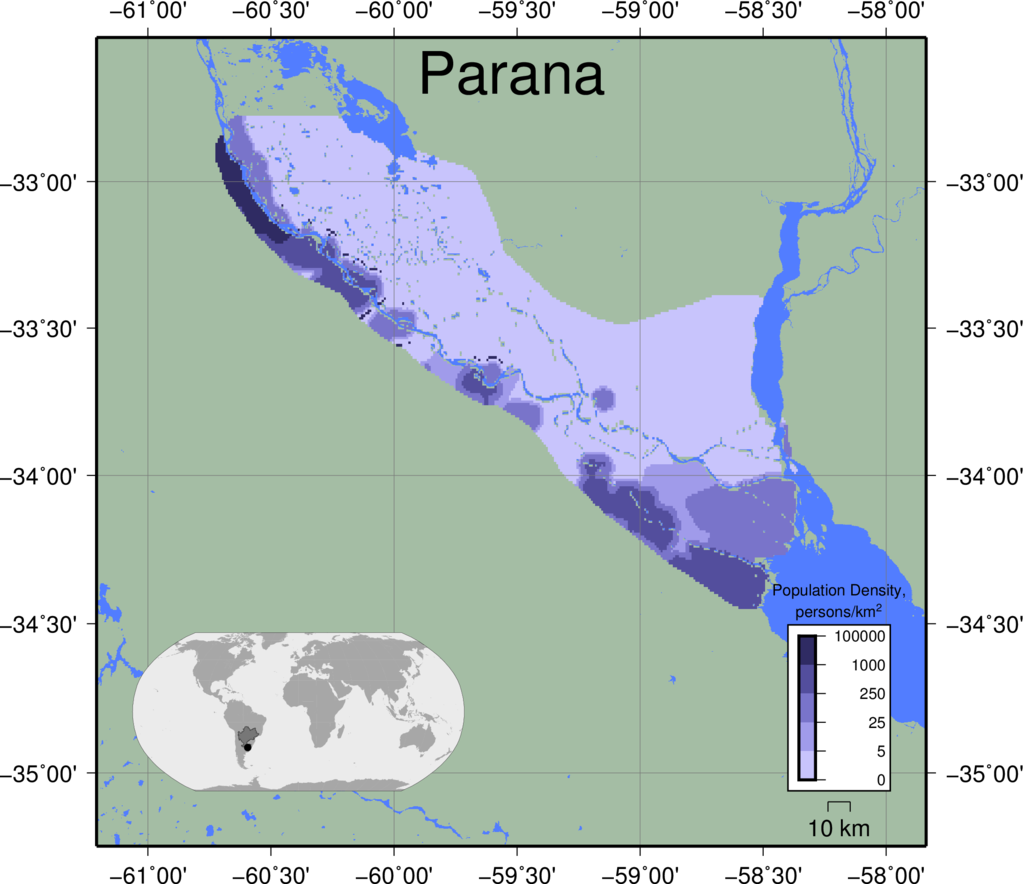 |
|
|
|
|
||
| Pearl | 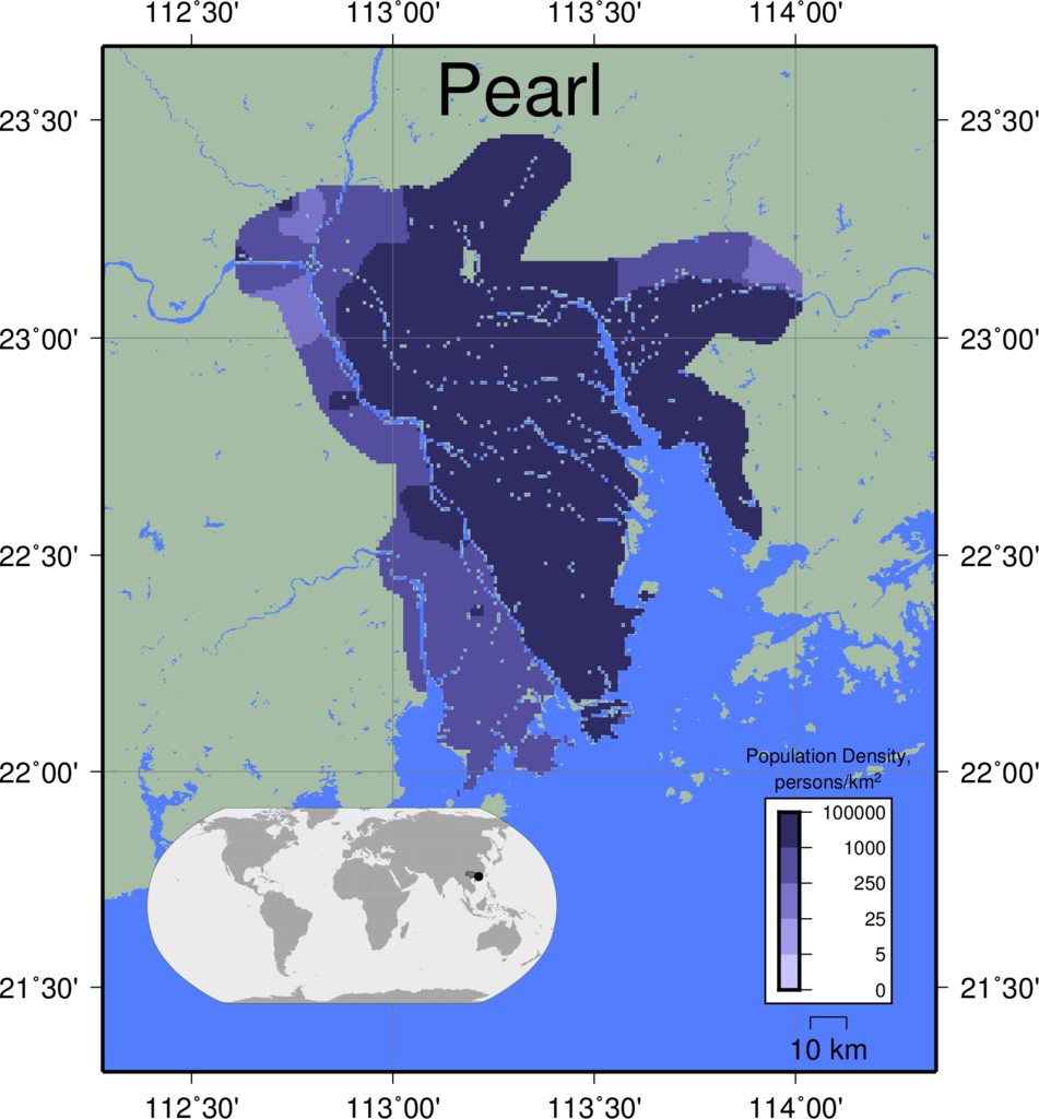 |
|
|
|
|
||
| Po | 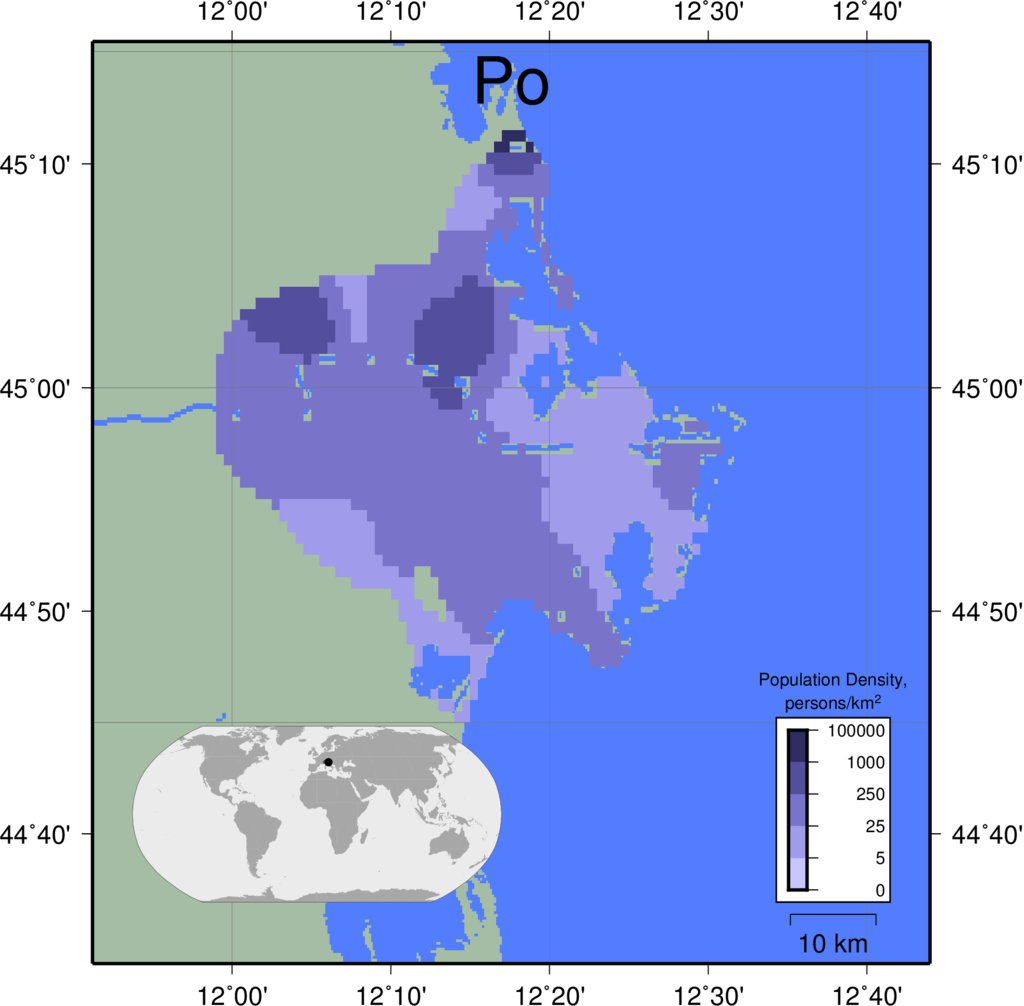 |
|
|
|
|
||
| Rhine | 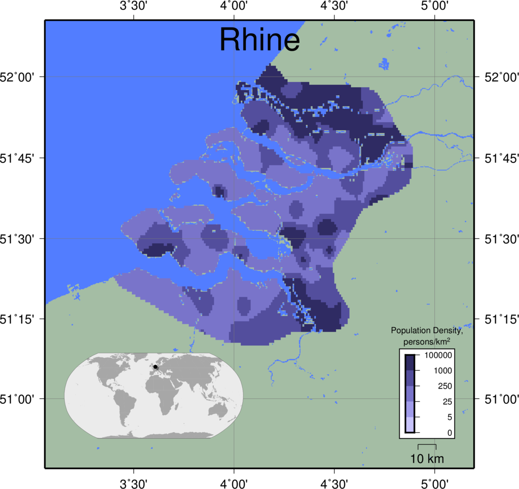 |
|
|
|
|
||
| Rhone | 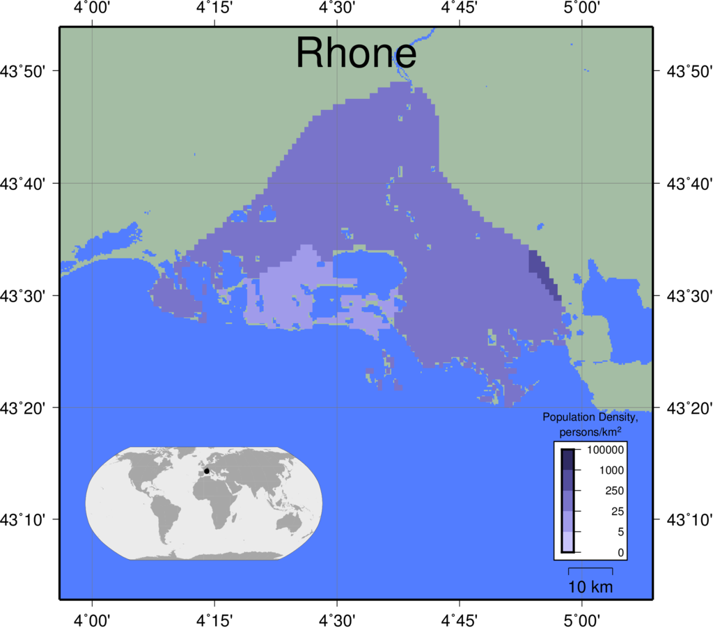 |
|
|
|
|
||
| Rio Grande | 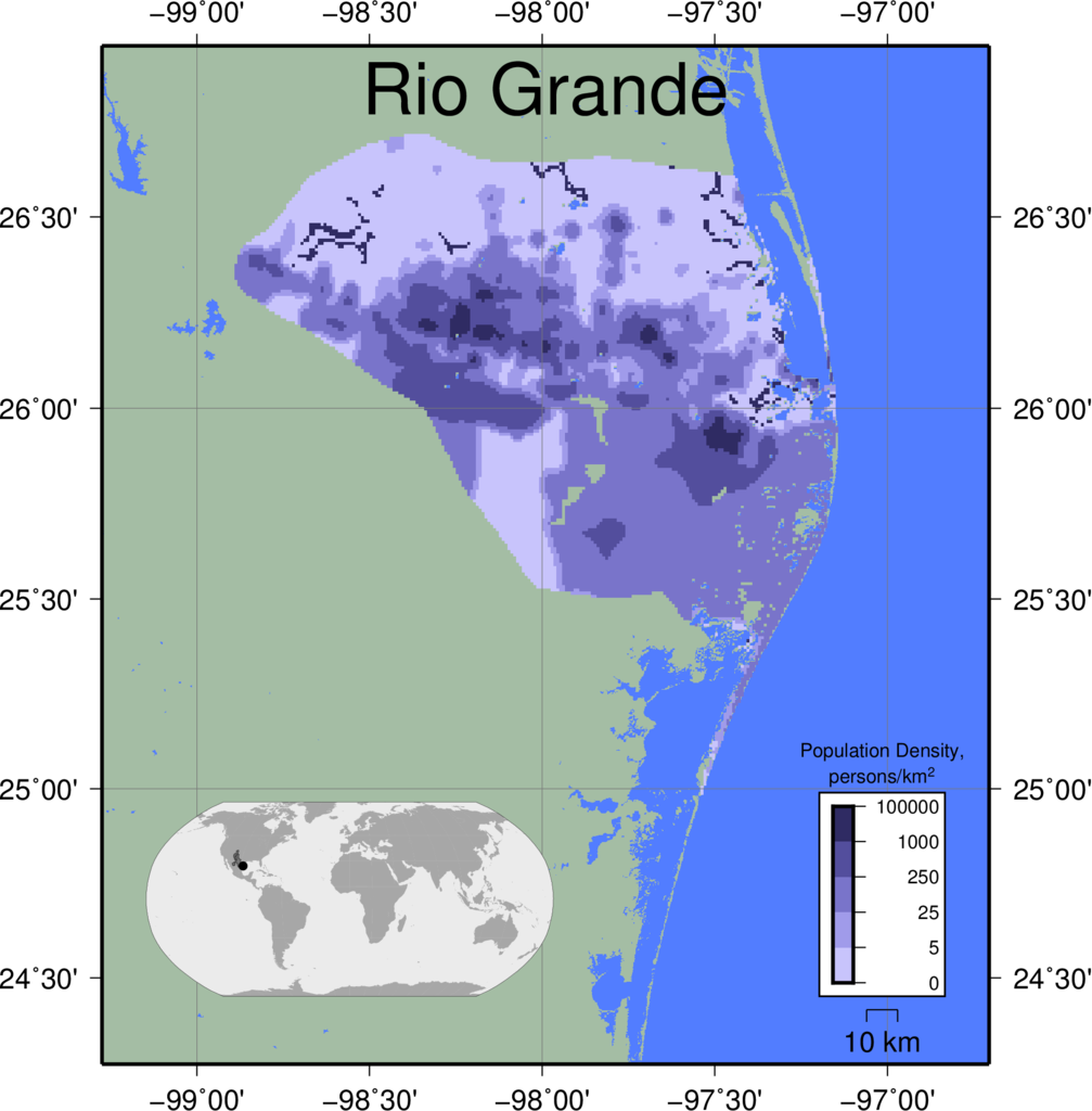 |
|
|
|
|
||
| Sao Francisco | 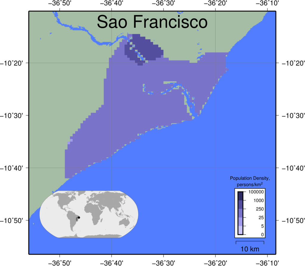 |
|
|
|
|
||
| Sebou | 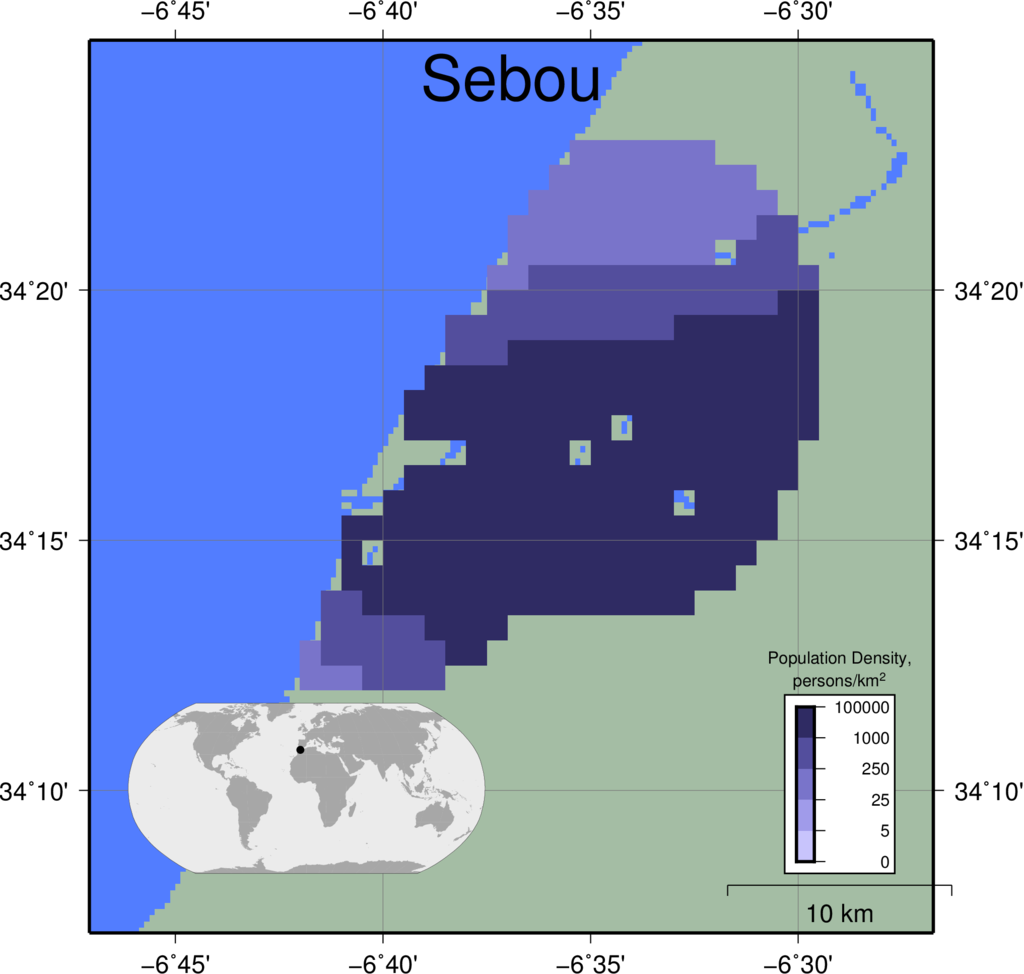 |
|
|
|
|
||
| Senegal | 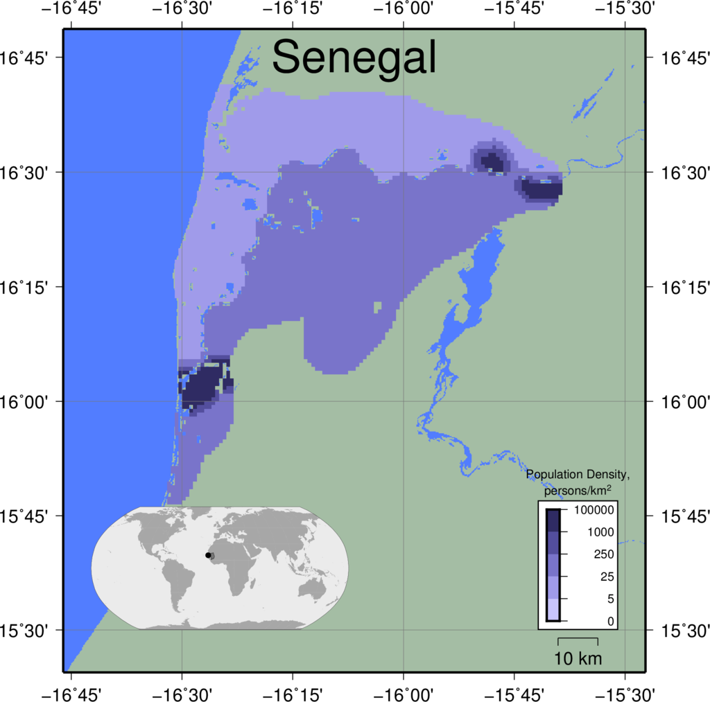 |
|
|
|
|
||
| Shatt-el-Arab | 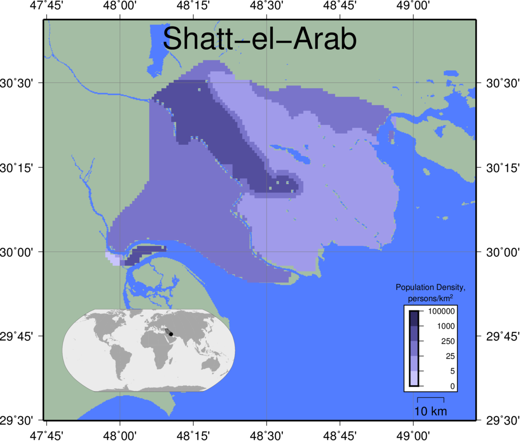 |
|
|
|
|
||
| Tana | 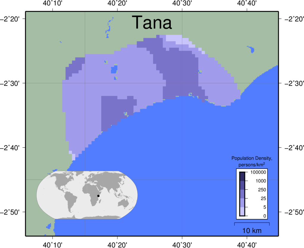 |
|
|
|
|
||
| Tone | 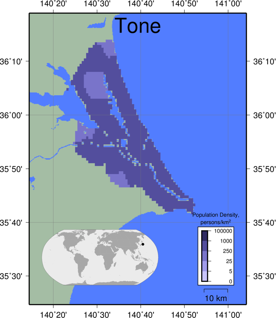 |
|
|
|
|
||
| Vistula | 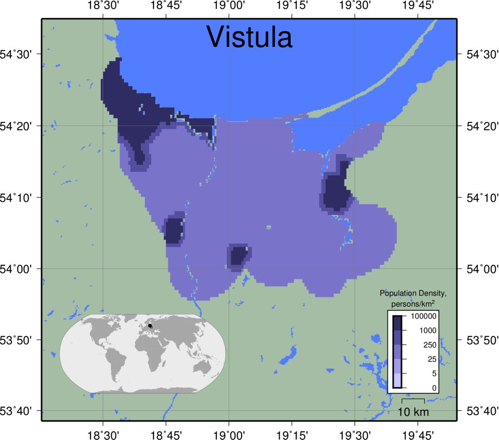 |
|
|
|
|
||
| Volta | 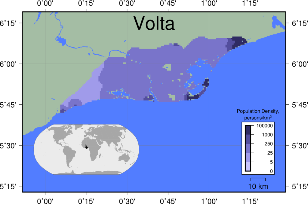 |
|
|
|
|
||
| Yangtze | 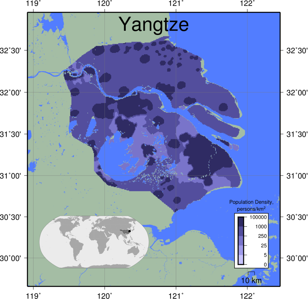 |
|
|
|
|
||
| Yellow | 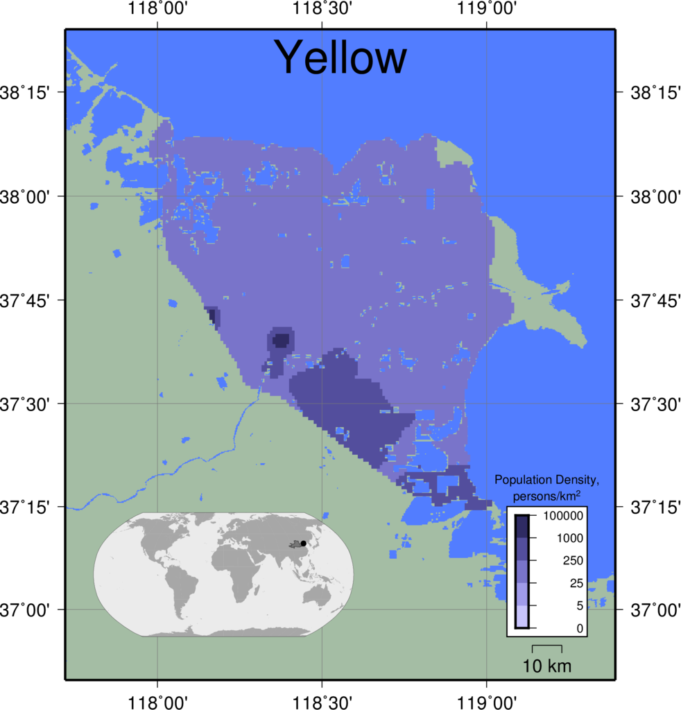 |
|
|
|
|
||
| Yukon | 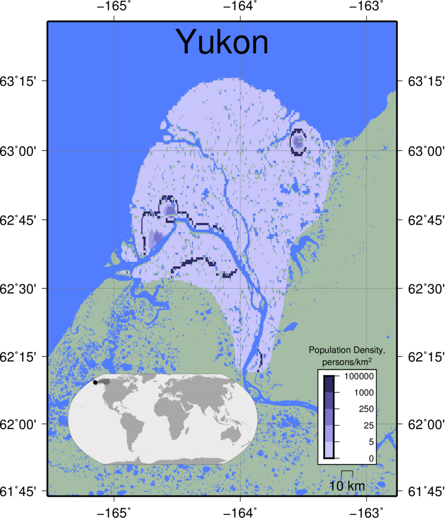 |
|
|
|
|
||